Understanding Hurricanes, Cyclones, and Typhoons: What's the Difference and How They Form
- Date & Time:
- |
- Views: 33
- |
- From: India News Bull

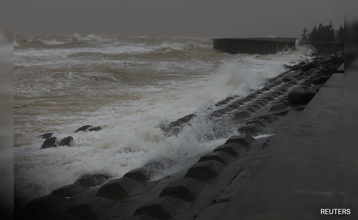
Waves approach as Typhoon Kalmaegi moves toward Da Nang city, Vietnam
Typhoon Kalmaegi has claimed at least 114 lives in the Philippines with numerous individuals still missing before making landfall in Vietnam on Friday. Another typhoon, Fong-Wong, is predicted to strike the Philippines around Sunday, potentially intensifying into a major storm by then.
Here are some essential facts about these powerful tropical systems: Despite different names, they are all technically tropical cyclones. The term "hurricane" is used in the Atlantic, Caribbean Sea, central and northeast Pacific regions. In the northwest Pacific, they're called "typhoons." The Bay of Bengal and Arabian Sea regions refer to them as "cyclones."
In the southwest Indian Ocean, "tropical cyclone" is the common terminology, while the southwestern Pacific and southeastern Indian Ocean regions use "severe tropical cyclones."
A storm receives a name and is classified as a tropical storm when winds reach 39 mph (63 kph). It achieves hurricane, typhoon, tropical cyclone, or cyclone status at 74 mph (119 kph). Storm strength is categorized into five levels based on wind speed, with Category 5 representing the most powerful storms exceeding 155 mph (249 kph). Australia employs a different classification system for storm intensity.
Experts classify Kalmaegi as a relatively strong typhoon. Its maximum winds in the Philippines reached 132 mph (213 kph), with sustained ground-level winds of 93 mph (150 kph).
The highest tropical cyclone wind speeds ever recorded were during Hurricane Patricia in the eastern Pacific in 2015, while Typhoon Tip in 1979 registered the lowest barometric pressure, a key meteorological measurement.
These systems rotate counterclockwise north of the equator and clockwise south of it.
The Atlantic and central Pacific hurricane seasons run from June 1 through November 30. The eastern Pacific season spans May 15 to November 30, while the northwestern Pacific experiences storms nearly year-round, with peak activity from May to November. In the south Pacific and Australia, cyclone season extends from November to April. The Bay of Bengal has two distinct seasons: April to June and September to November.
Vietnam typically experiences typhoon landfalls during this time of year.
The northwestern Pacific region, where Typhoon Kalmaegi struck, is Earth's most active tropical cyclone zone due to year-round warm water, weak upper-level crosswinds, and frequent thunderstorm activity that provides favorable conditions for storm formation, according to Kristen Corbosiero, professor of atmospheric and environmental sciences at the University at Albany.
By this point in the year, the Northwest Pacific typically averages 23 named storms, with 14 developing into typhoons, according to Colorado State University's storm database. A normal year produces 27 named storms in this region. Kalmaegi and Fung-Wong represent the 26th and 27th named storms of the season, with Kalmaegi being the 15th typhoon. While slightly above average in storm count, Corbosiero notes this has generally been a weaker season. The accumulated cyclone energy metric, which combines storm strength, frequency, and duration, shows this season at only 62% of average so far. Kalmaegi ranks as the fourth-strongest typhoon this season.
For comparison, the Atlantic averages 14 named storms annually, with 13 occurring this year, including Hurricane Melissa, which caused significant destruction in Jamaica and Cuba.
Since the Northwest Pacific maintains water temperatures sufficient to fuel storms year-round, atmospheric disturbances often trigger cyclone development, Corbosiero explains. In many cases, including the current situation, the Madden-Julian Oscillation (MJO) plays a crucial role. This natural tropical system originates near the Indian Ocean and travels eastward, enhancing rainfall and storm activity ahead while suppressing thunderstorms behind it, completing a global circuit in 30 to 60 days.
A strong MJO can catalyze tropical cyclone formation. This pattern was active in the Northwest Pacific earlier this summer before temporarily weakening as the oscillation moved eastward, Corbosiero notes. A recent strong MJO has contributed to the formation of these current storms, and is now approaching the international dateline, approximately one and a half to two weeks away from potentially influencing late-season tropical storm development in the Atlantic.
The World Meteorological Organization maintains storm naming lists using regionally familiar names. Names associated with particularly destructive or deadly storms are retired and replaced to avoid confusion, such as Katrina following the 2005 New Orleans devastation. The Philippines maintains its own naming system, which is why Typhoon Kalmaegi is also known locally as Tino.
Source: https://www.ndtv.com/world-news/confused-between-hurricane-cyclone-typhoon-heres-the-difference-9591774